What’s in a name?

There’s a spot in Kingston just west of Exit 9 on Route 3, elevation about 68 feet, which has been long known as Thomas’ Hill.
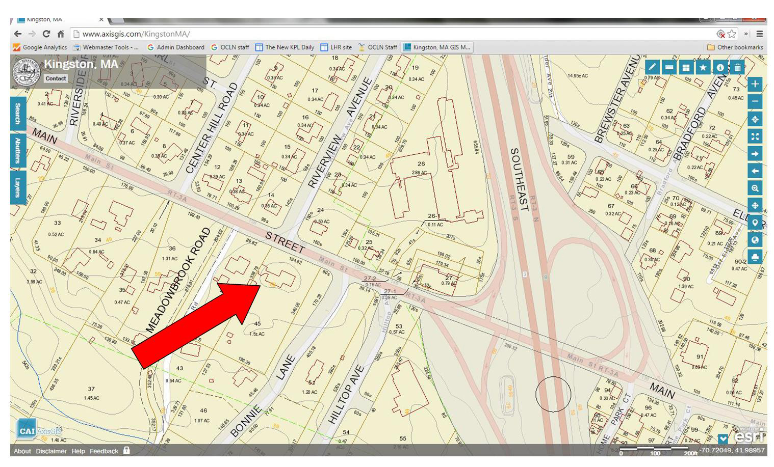
Area around Thomas' Hill from Kingston GIS, 2016
Area around Thomas’ Hill from Kingston GIS, 2016

[This screen shot is from the Town’s GIS, which is just amazing. Give it a try!]

In her 1933 description of Kingston place names, Emily Fuller Drew tells us that

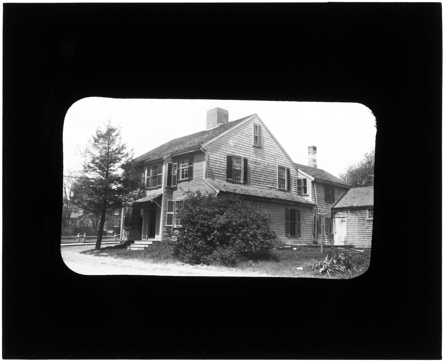
Colonel Thomas’ Hill is located from the Great Bridge up the slope, going south of the River. This hill was named for the Thomas family whose home was located on the hill.

That’s this house.
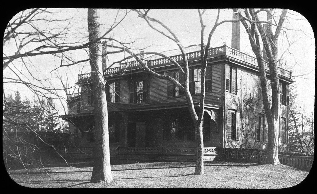
John Thomas House, Thomas Hill, 156 Main Street, circa 1900

Here’s a view south, up the hill towards the Thomas House, taken from a spot just before the Great Bridge over the Jones River.
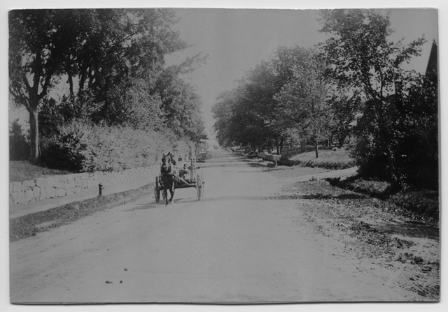
Main Street, looking south up Thomas' Hill, circa 1900
Main Street, looking south up Thomas’ Hill, circa 1900

And here are a couple of views looking the opposite way down the hill.
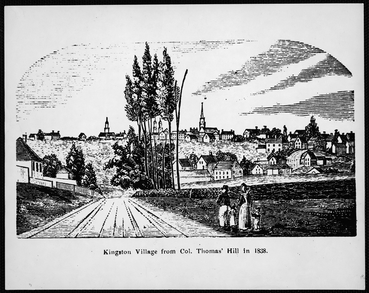
Kingston Village from Col. Thomas' Hill in 1838, reproduced 1975
Kingston Village from Col. Thomas’ Hill in 1838, reproduced 1975

[This wood cut is from this book, originally published in 1839.]
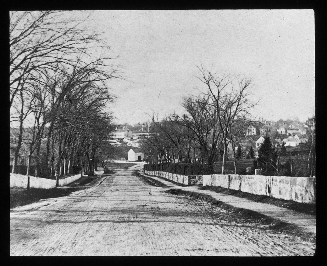
 

Main Street, looking north down Thomas' Hill, 1876
Main Street, looking north down Thomas’ Hill, 1876

And here’s one of indeterminate direction, but with a nice shady feel to it.
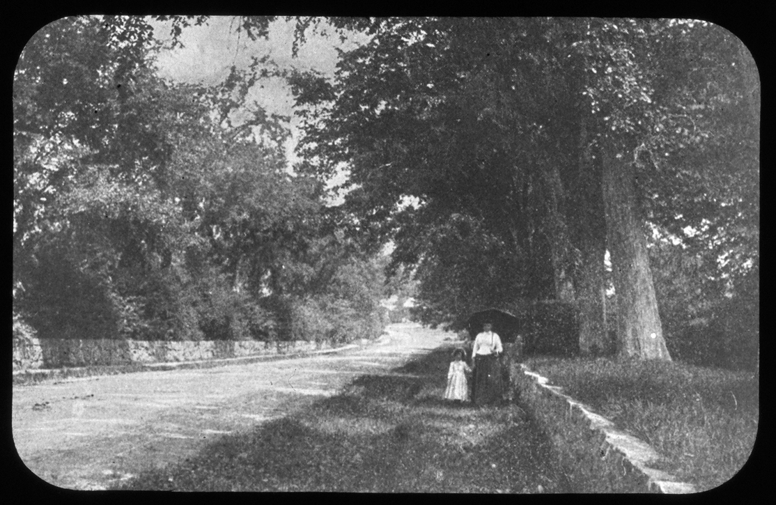
Strolling on Thomas' Hill, 1890
Strolling on Thomas’ Hill, 1890


These images all bear the description “Thomas’ Hill,” because that’s what’s it’s been called for quite some time.  Now, though, there’s a need to update our shared geographical vocabulary. There’s a whole group of Kingstonians with a completely different point of reference, for whom this area doesn’t relate at all to an 18th century Kingston family or their stately home atop the hill.

Let the historical record now reflect the vernacular alternative: “HoJo Hill.”
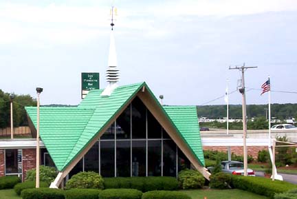
 

Kingston-Plymouth Howard Johnson's. Photograph courtesy of Dan Holbrook 2003, via highwayhost.org
Kingston-Plymouth Howard Johnson’s. Photograph courtesy of Dan Holbrook 2003, via highwayhost.org

Here’s more.


Source: Jones River Village Historical Society Lantern Slides IC4; LHR Image Collection IC7; Mitchell Toabe Papers MC18; and highwayhost.org.

For more, visit the Kingston Public Library, and the Local History Room, and the full blog at piqueoftheweek.wordpress.com.
 

The devil is in the details

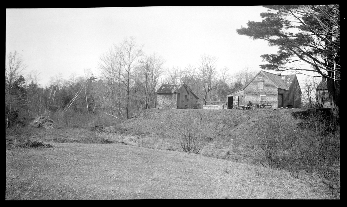
Lyman Cushman's barns and sheds, Elm Street, 1925
Lyman Cushman’s barns and sheds, Elm Street, 1925

Emily Fuller Drew wrote an extensive caption on the back of a print of this image:

1925 Lyman Cushman’s barns and shed on Elm St. Taken from the now Harper barn. A freshet tore down thro the valley, the Winter Meadow Brook and the canal which took its place, washing out dam and canal and changing the valley as shown. The dam or dyke at Russells Pond was rebuilt but a new canal from the Pond to Sylvys Place Pond was made to replace the former one. Part of the bank of the old canal shows near Pine Tree at right.

Another view of the area was featured here. The main house to which the outbuildings belong, the Lyman Cushman/John Cushman house at 16 Sylvia Place Road, isn’t shown. The Harper barn from which Emily took the photo, sits behind the house at 4 Sylvia Place Road.

A discerning eye can just make out a figure, maybe a man, seated in a chair propped up against the shingled wall with a table at his left.  It could be Lyman Cushman (1851-1925); we don’t know. We don’t have a photo of him, and Emily didn’t mention him in the caption, but just a couple of photos later…

Lyman Cushman's cat, 1925
Lyman Cushman’s cat, 1925

Emily walked up the hill from the Harper’s barn and took this photo, which she later captioned “Lyman Cushman’s cat.” Nice detail.

Source: Emily Fuller Drew Collection MC16

For more, visit the Kingston Public Library, and the Local History Room, and the full blog at piqueoftheweek.wordpress.com

Well, well, well, that’s the Point

The Point, at the junction of Main and Summer Streets, 1886

One of the many lantern slides collected by Emily Fuller Drew for the Jones River Village Historical Society, this image shows the Point, where Summer Street peels away from Main Street. It was the center of Kingston before the railroad came through.

The index card of Emily’s notes on this slide reads:

20. “The Point,” jct. Main & Summer Sts. 1886

Main Street was formerly the Bridgewater Road; Summer was in early day called the Boston Road. Where they joined or separated, was called the “Point.” The well which was built by Samuel Foster, Benjamin Samson and Joseph Stacey on Mr. Stacey’s land was called the Point Well and, as time went on, the Old Point Well. The Rev. Samuel Glover, minister of the Baptist Society lived at #39. His son Henry was born there. In memory of his early days in Kingston. Mr. Henry Glover in his later and wealthier years, gave the Town of K a drinking fountain for dumb animals to be placed at The Point and a sum of money to maintain it. (Mr. Glover also gave funds for the present Baptist Church and a fund to maintain it.)

Emily’s “#39” refers not to an address, but to another lantern slide.

Samuel Foster house, 25 Summer Street, 1922

The corresponding card:

39. Samuel Foster house (front) 1922

In 172_, Samuel Foster bought of Maj. John Bradford a piece of land, part of the Bradford farm, joining the land of John Brewster, #135, and lying on the east side of Boston Road ( Summer St.) Here Foster built a house in which he lived __ years. In 175_, he sold the place to Wrestling Brewster, son of Deacon Wrestling and built a second house, a much larger and more pretentious house, nearer the junction of Green and Summer Streets, the present Harry Cook house (east side of Summer St.).

And, #135 refers to…

135. John Brewster house, Main and Linden Streets, 1922

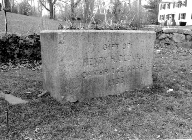
This was one of several houses on Main and Summer Streets that were demolished in the early 1920s…oh, we could follow Emily’s references around for days! But let’s stop there and go back to the Point. The well in the first lantern slide was replaced in 1888 with this public watering trough or as Emily put it, “drinking fountain for dumb animals.”

Henry R. Glover Watering Trough, 1997

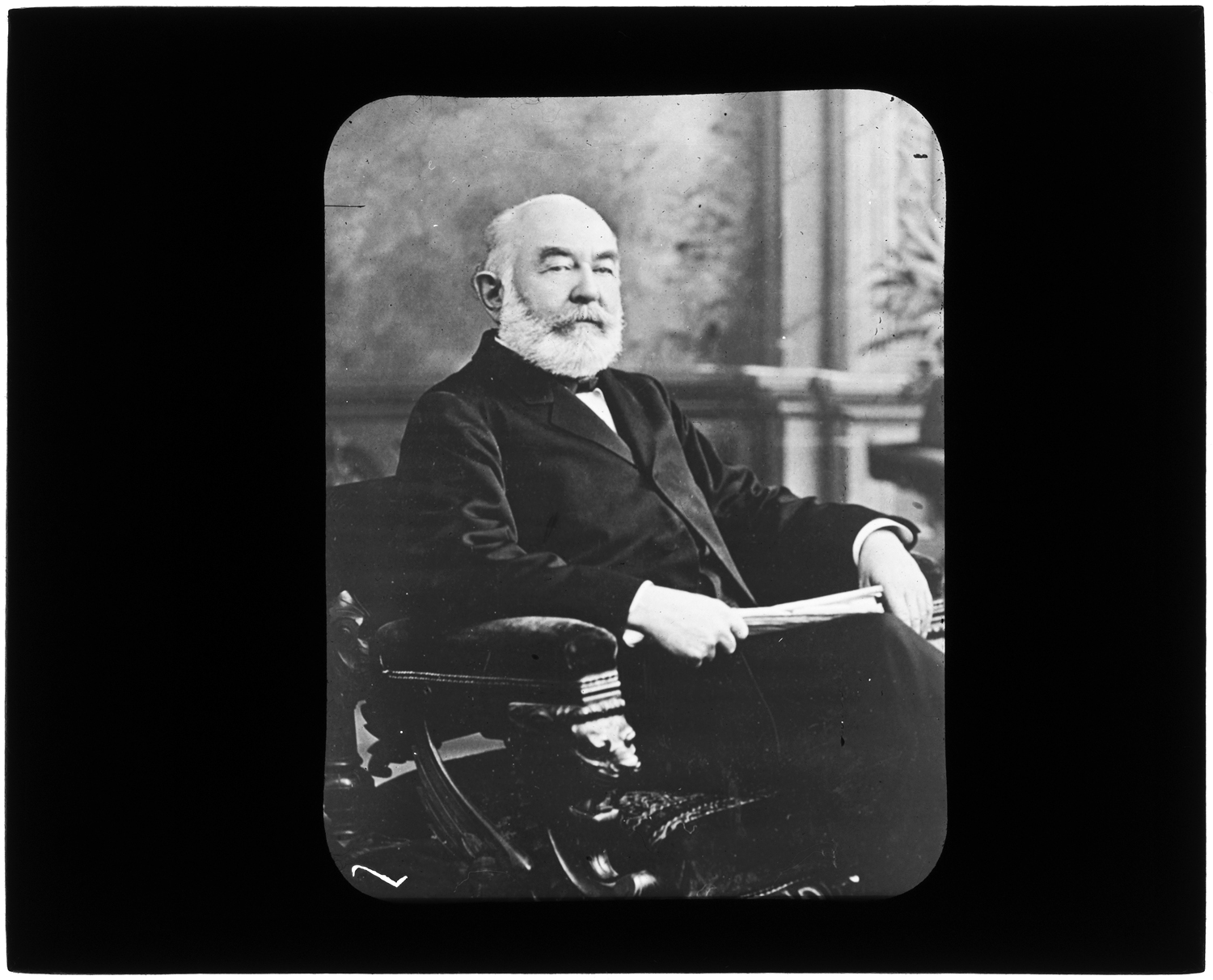
Here’s the benefactor himself, Henry Rogers Glover (1814-1893), “in his later and wealthier years.”

Henry R. Glover, seated portrait, circa 1890

According to his obituary (thanks Cambridge Public Library), he was a manufacturer and wholesale dealer of mattresses and curled hair, and further, “He has always been rich.”

Sources: Jones River Village Historical Society Collection MC29 and Lantern Slides IC4; Mass. Historical Commission MACRIS Digital Photographs IC13

For more, visit the Kingston Public Library, and the Local History Room, and the full blog at piqueoftheweek.wordpress.com

Evergreen Cemetery Pond

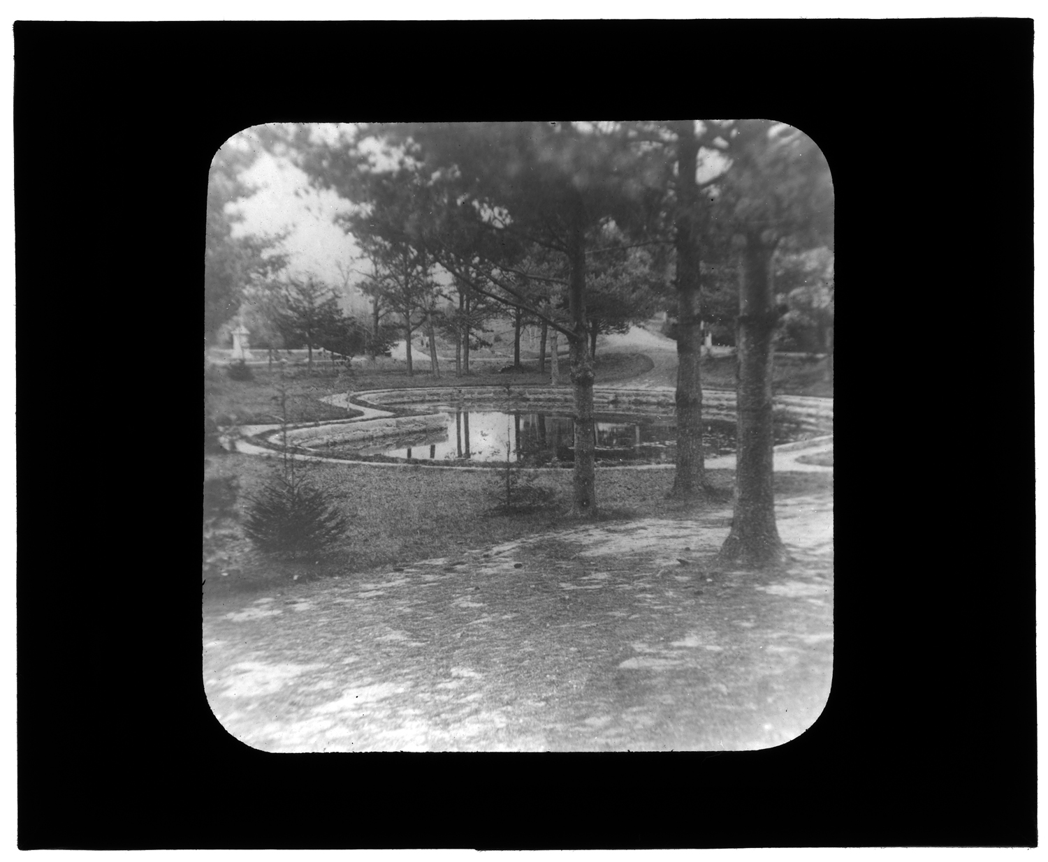
Evergreen Cemetery Pond, 1876


84. Evergreen Cemetery Pond, 1876

Naturally a damp, spring spot. When cemetery was planned [in 1853], the spot was drained and curbed as shown. Later the pines were cut down or broke down from winter ice, and the spot was landscaped. Mr. Edgar Reed gave the granite seat on the north side of the pond.


Source: Text from Emily Fuller Drew’s lantern slide card file; image from Jones River Village Historical Society Lantern Slides IC4.  Scanned with LSTA funds through the Massachusetts Board of Library Commissioners and digitized at the Boston Public Library in conjunction with the Digital Commonwealth)


For more, visit the Kingston Public Library, and the Local History Room, and the full blog at piqueoftheweek.wordpress.com.

Saturday’s cemetery tour postponed

The tour of Evergreen Cemetery planned by the Jones River Village Historical Society for this Saturday, October 4, has been postponed.

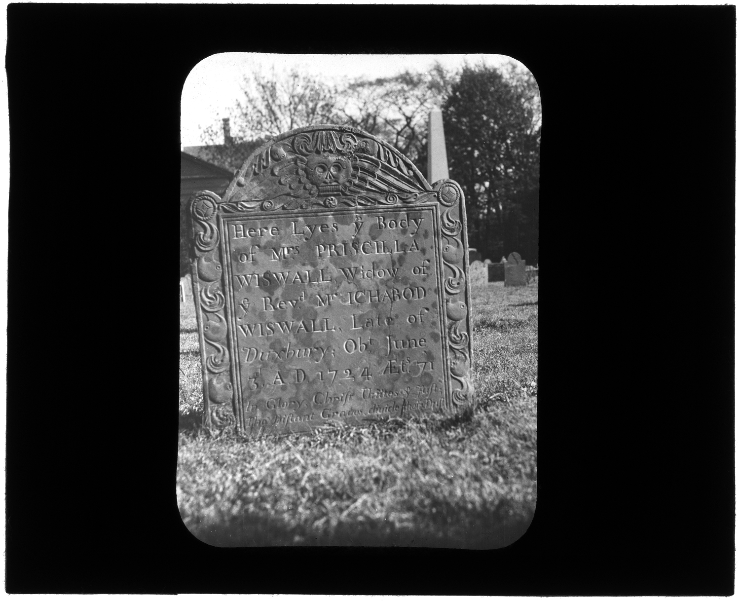
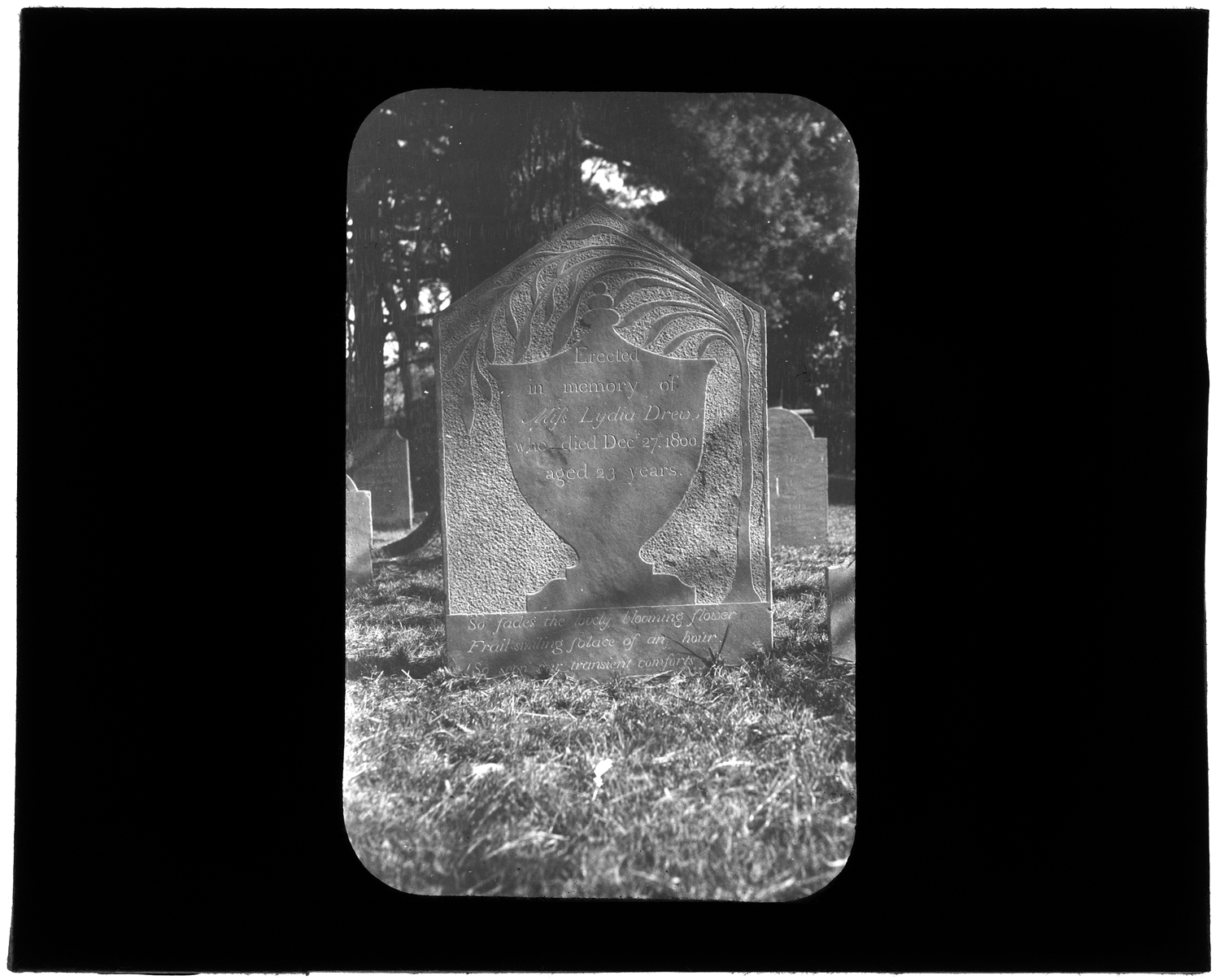
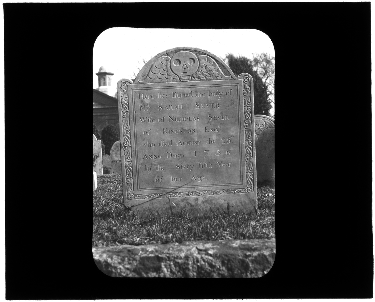
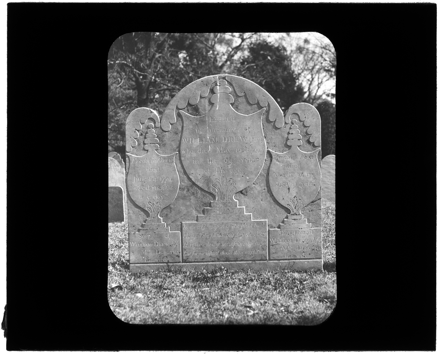
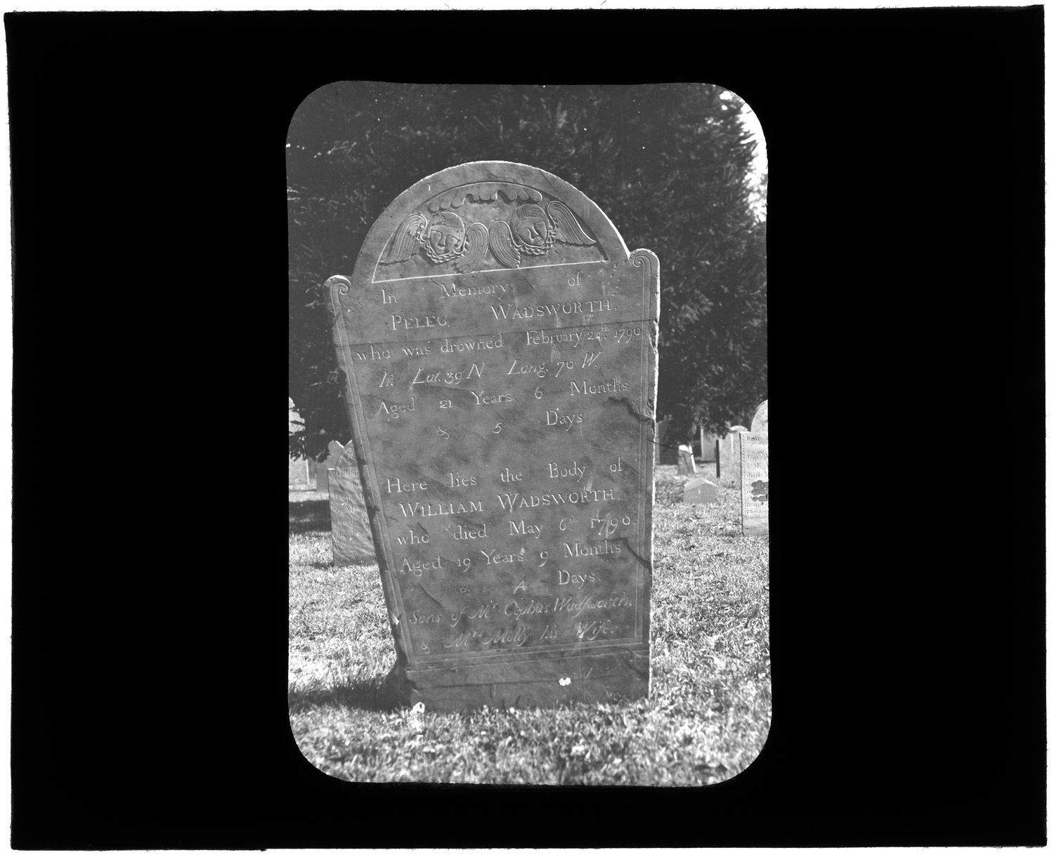
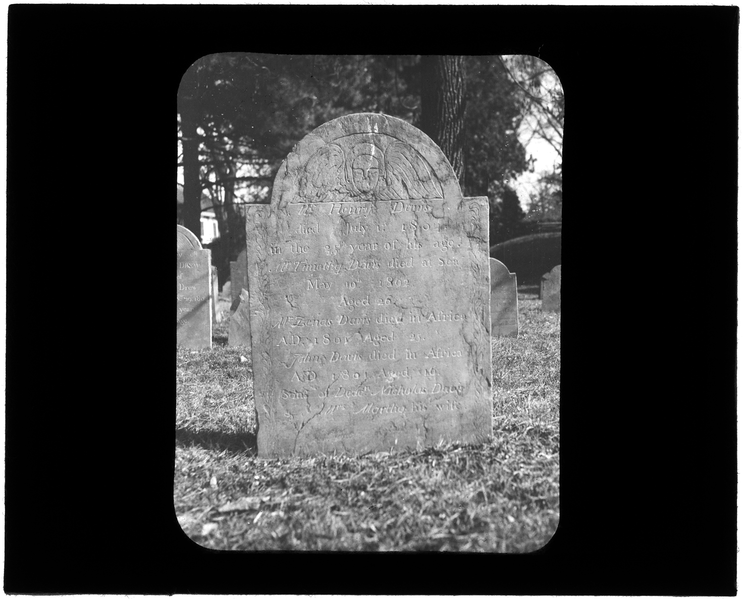
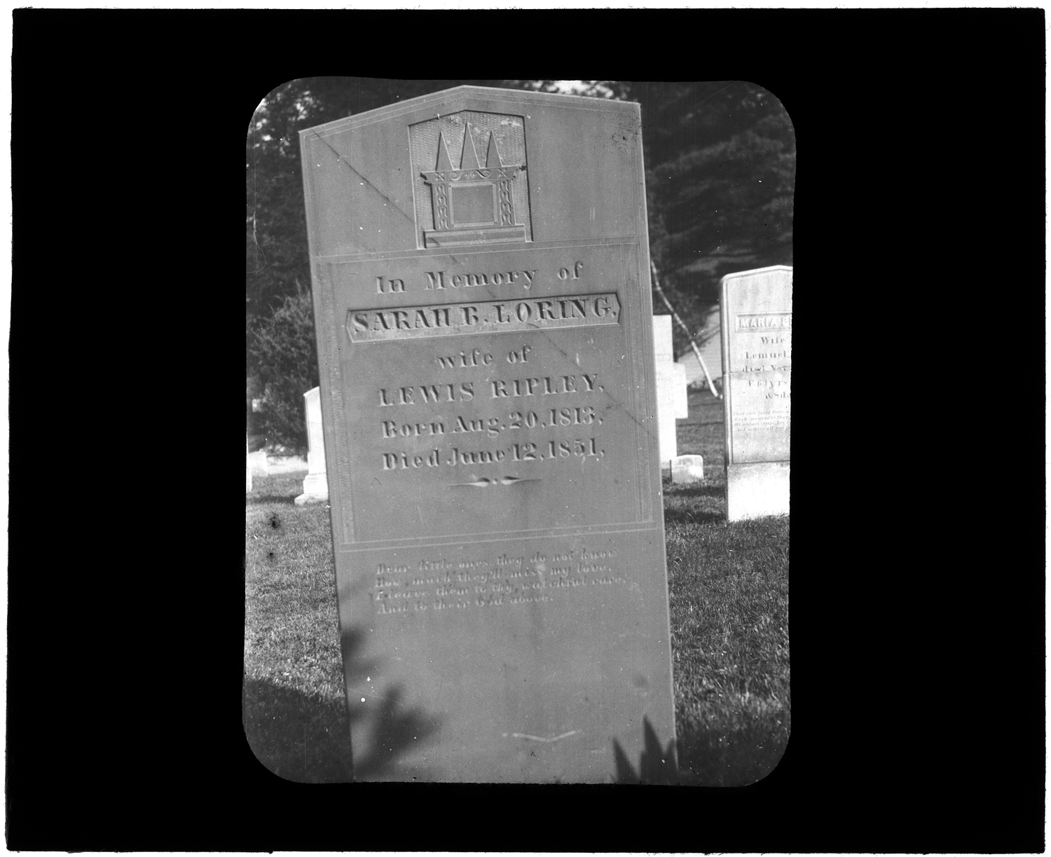
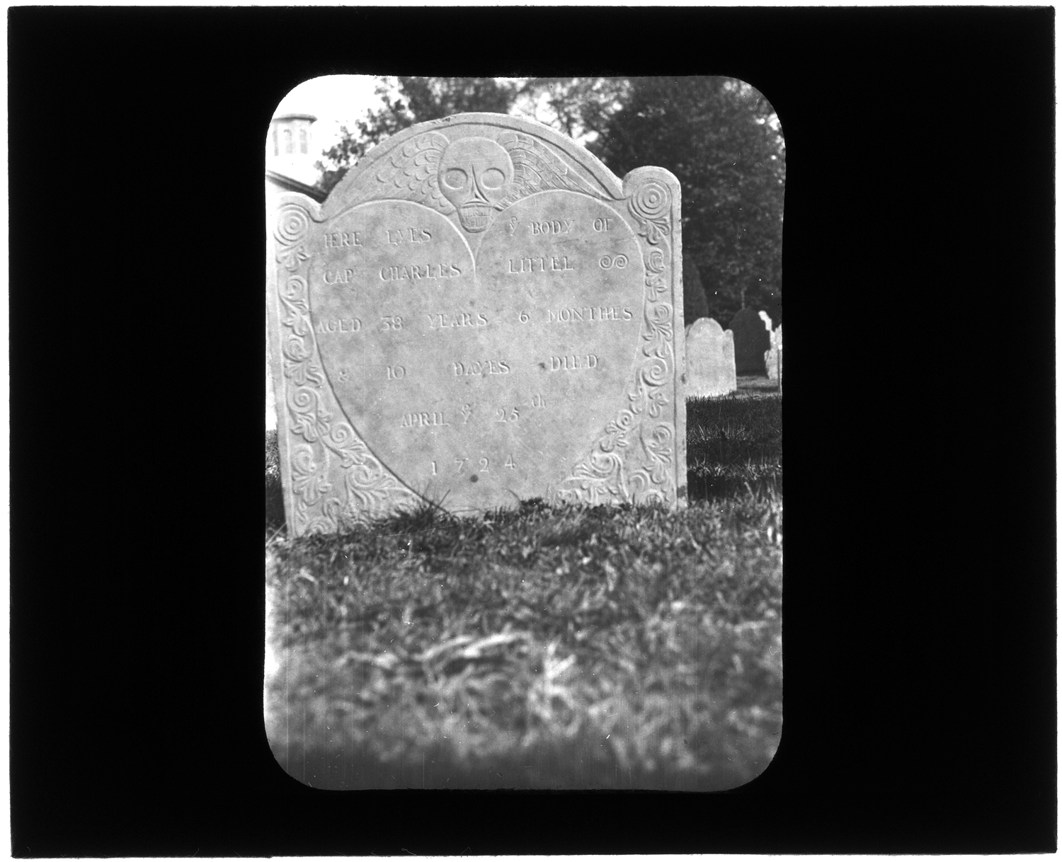
As a small consolation, here are few interesting tombstones, headstones, gravestones, or as the Thesaurus of Graphic Materials from the Library of Congress would have it, Tombs & sepulchral monuments from Kingston’s Old Burying Ground.


Priscilla Wiswall   June 3, 1724
Priscilla Wiswall June 3, 1724
Lydia Drew  Dec. 27, 1800
Lydia Drew Dec. 27, 1800
Sarah Sever  Aug. 25, 1756
Sarah Sever Aug. 25, 1756
William Drew  May 10,1795
William Drew May 10,1795
Peleg Wadsworth  Feb. 24, 1790
Peleg Wadsworth Feb. 24, 1790
Henry Davis  May 10, 1802
Henry Davis May 10, 1802
Sarah B. Loring  July 12, 1851
Sarah B. Loring July 12, 1851
Charles Littel  July 25, 1724
Charles Littel July 25, 1724

A different Charles Little lies here.


Source: Jones River Village Historical Society Lantern Slides IC4.  Scanned with LSTA funds through the Massachusetts Board of Library Commissioners and digitized at the Boston Public Library in conjunction with the Digital Commonwealth)


For more, visit the Kingston Public Library, and the Local History Room, and the full blog at piqueoftheweek.wordpress.com.
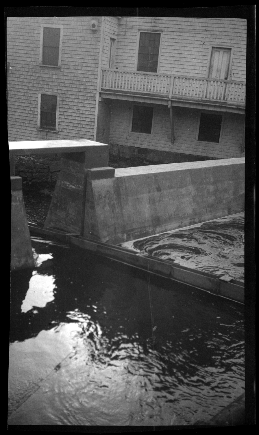
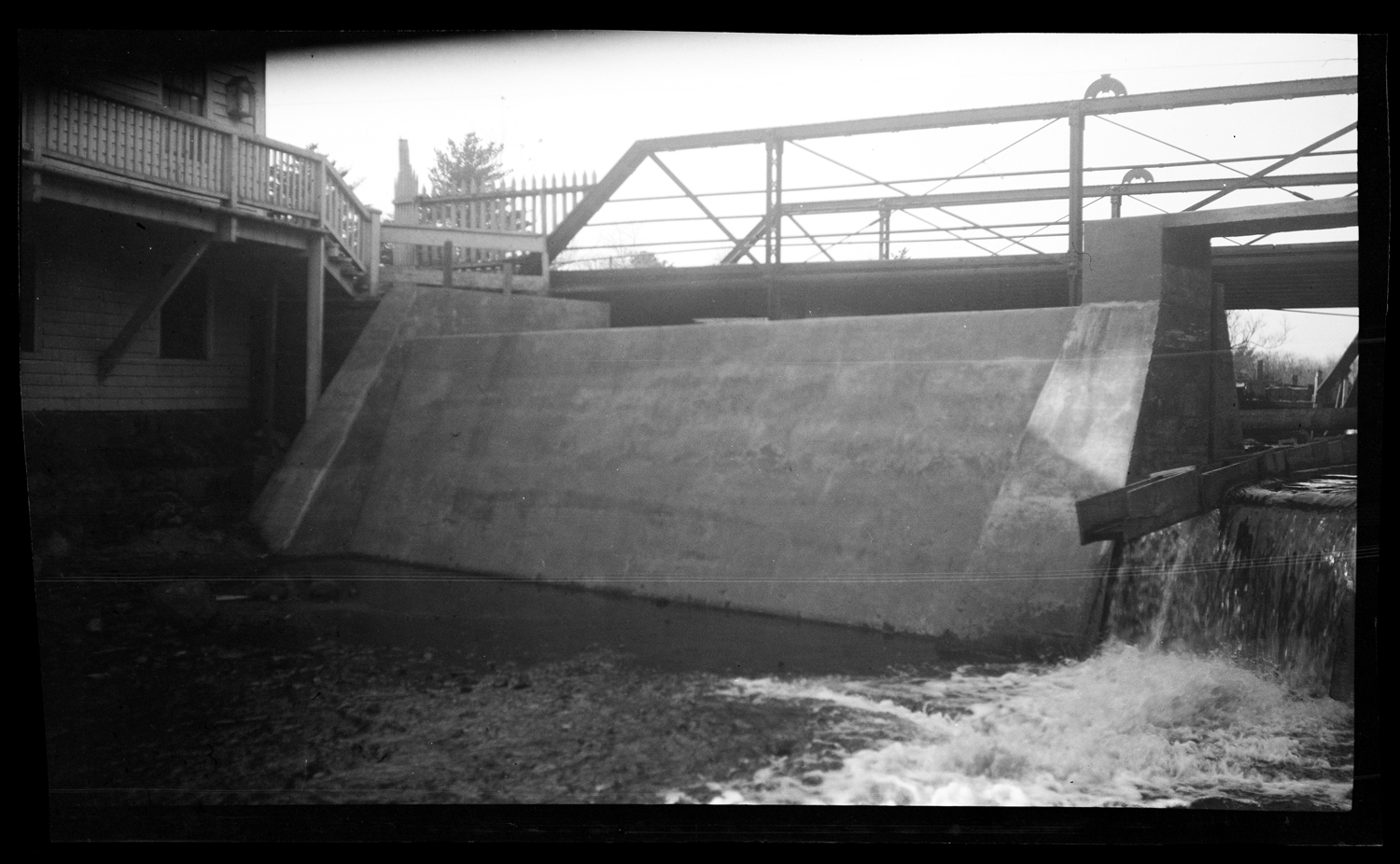
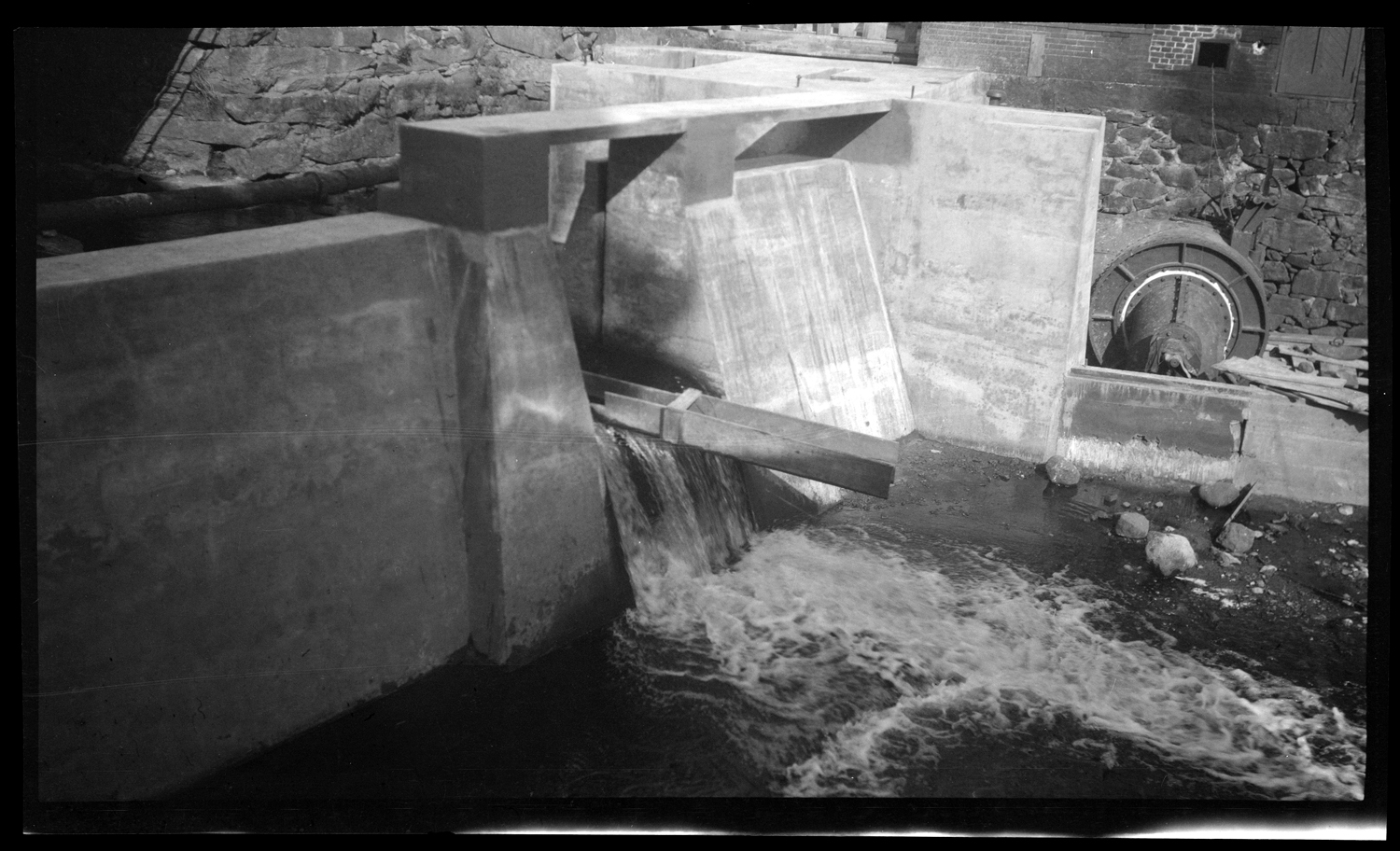
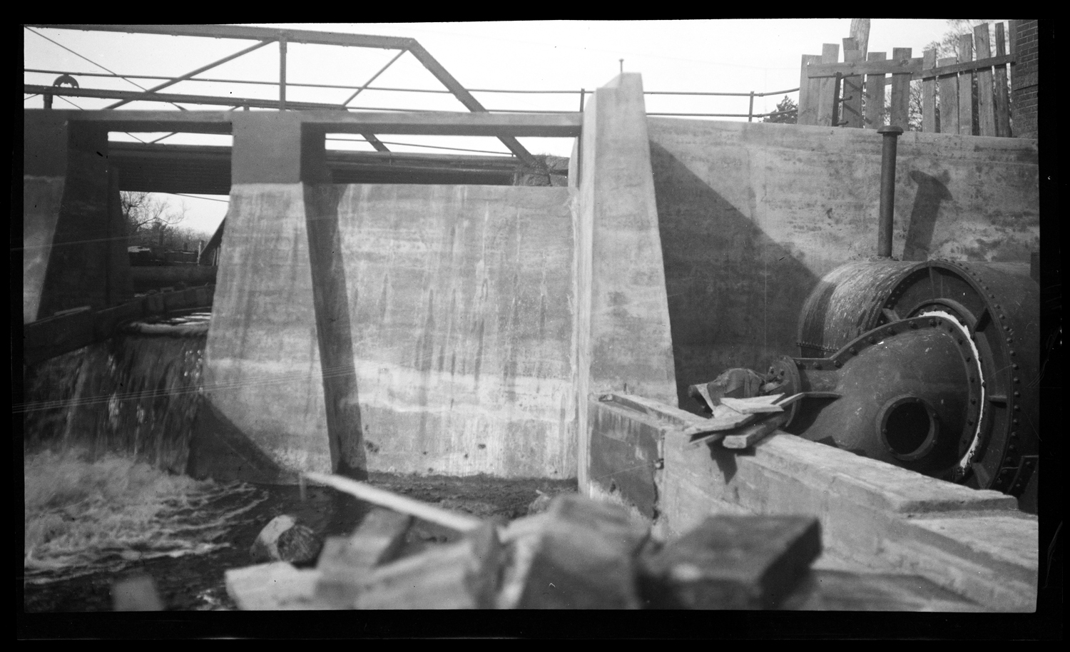
Dam!

The Elm Street dam may go the way of its upstream relative, the dam at Triphammer Falls just off Wapping Road, which was removed in 2011.  The question of dam removal is a complex one, made doubly so in Kingston and other New England towns by the age of many of the dams.

To find out more about the issue, take a look at the FAQ and other information about dam removals posted by American Rivers, a non-profit focused restoration and conservation of rivers across the country; and at the Dam and Seawall Repair or Removal Fund run by Massachusetts’ Executive Office of Energy and Environmental Affairs.

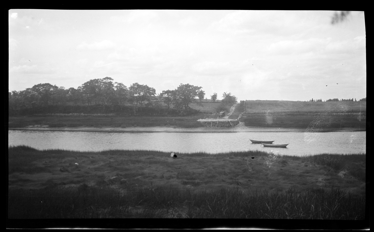
Here are some photographs of the Elm Street dam when it was new, sometime in the 1920s.

The new Elm Street dam, circa 1925, by E. Bird


Source: Emily Fuller Drew Collection MC16.  Negatives scanned with LSTA funds through the Massachusetts Board of Library Commissioners and digitized at the Boston Public Library in conjunction with the Digital Commonwealth)


For more, visit the Kingston Public Library, and the Local History Room, and the full blog at piqueoftheweek.wordpress.com.
Vacation

The Local History Room will be closed from July 21 through August 4.

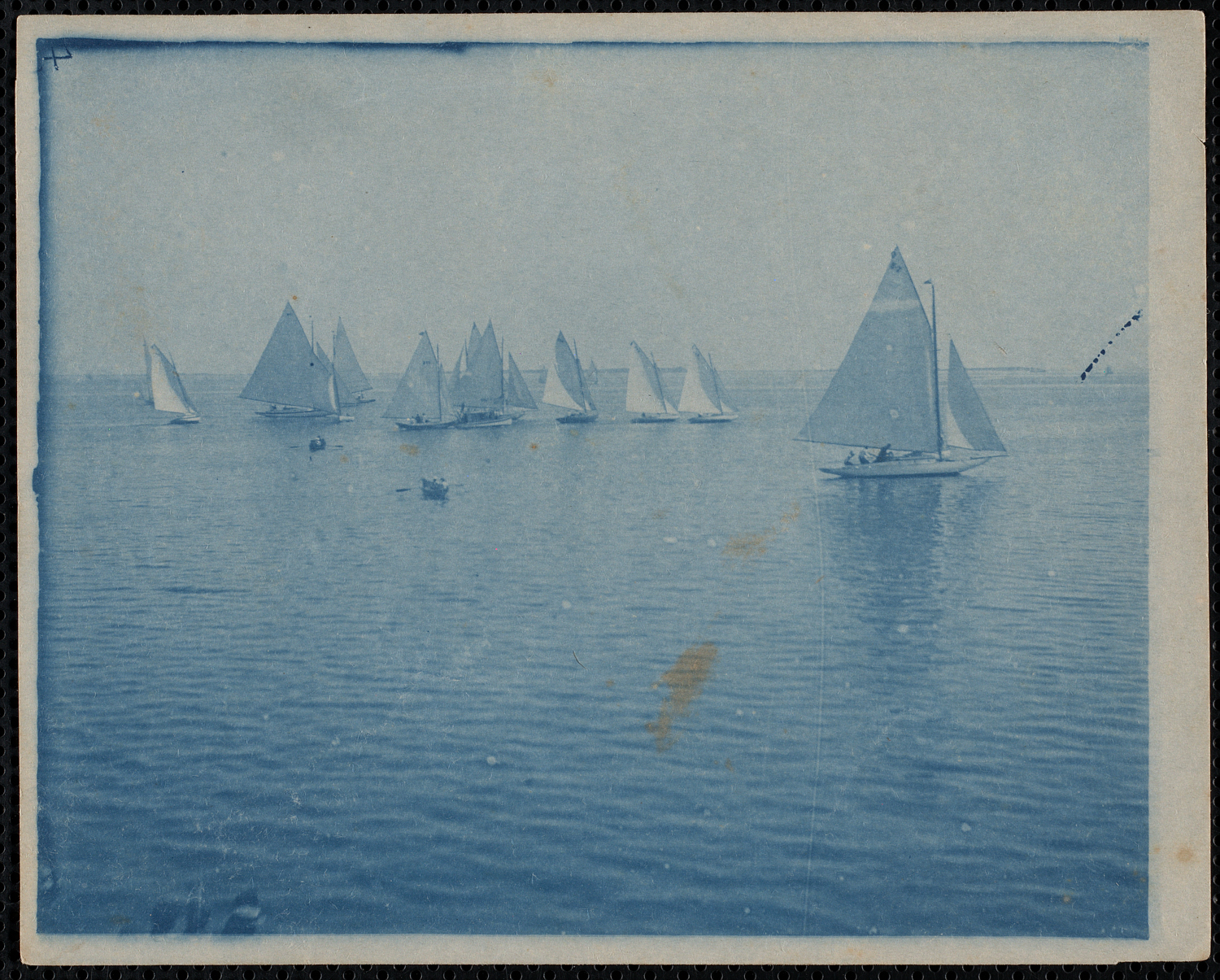
Regatta on Kingston Bay, circa 1905

If you click on the photo to display a larger size, you may be able to make out what looks like the Bug Light on the horizon on the right side of the the photo (under the black dashed line).


Sources: Cyanotype from the Delano Photograph Collection IC11 (scan federally funded with LSTA funds through the Massachusetts Board of Library Commissioners and digitized at the Boston Public Library in conjunction with the Digital Commonwealth)


For more, visit the Kingston Public Library, and the Local History Room, and the full blog at piqueoftheweek.wordpress.com.
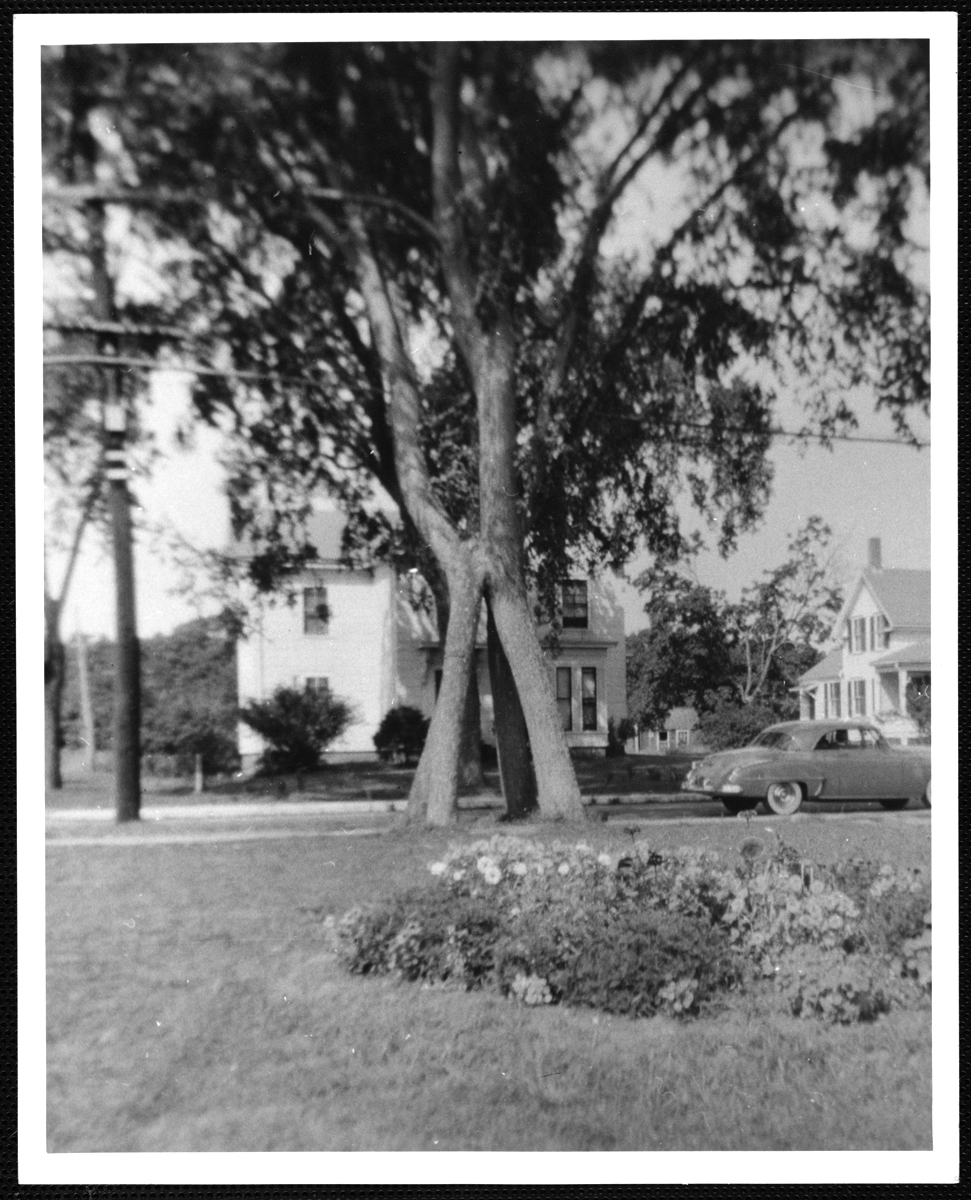
Four-trunk elm tree

The four-trunk elm tree, about 1955.

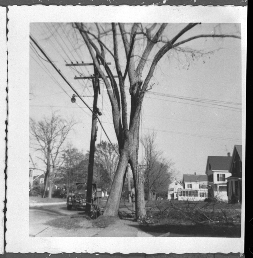
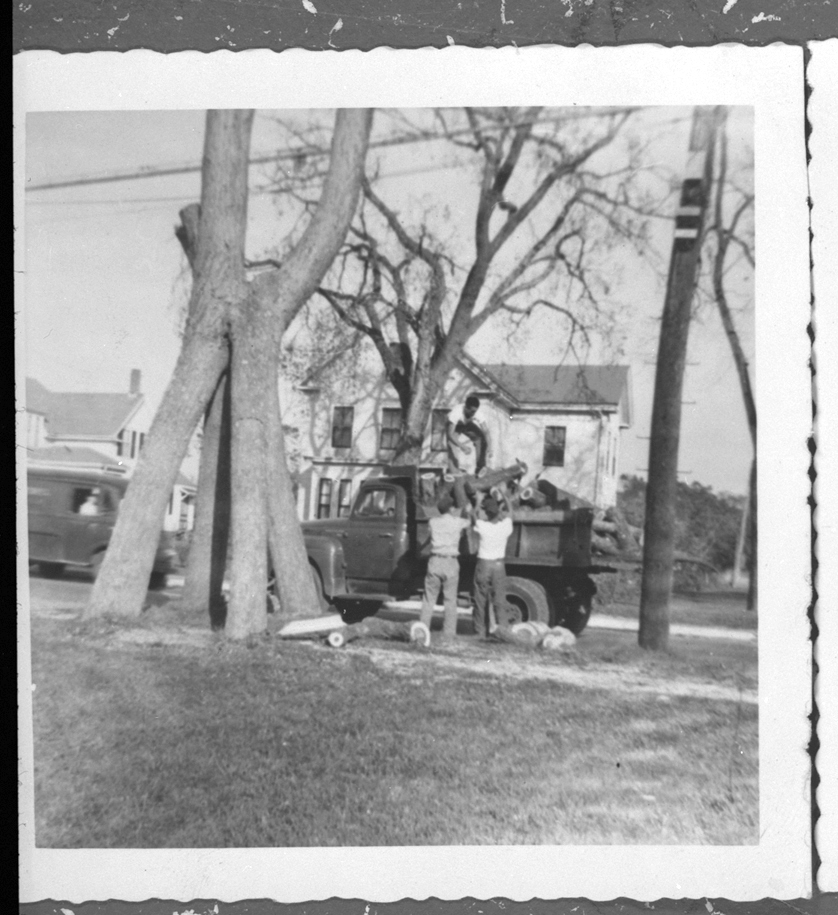
The four-trunk elm tree that stood on Main Street near Shirley Avenue was the stuff of childhood legend.  The sidewalk ran underneath and between the trunks so that a daring kid could ride a bike straight through, and a real heroic type would do it no-hands style.

The four-trunk elm tree, about 1959.

The mighty tree fell victim to the ravages of Dutch Elm disease around 1959, and a little bit of childhood magic went with it.

The four-trunk elm tree, about 1959.


Sources: Mitchell Toabe Papers MC18 (first image); LHR General Image Collection IC7 (next two)


For more, visit the Kingston Public Library, and the Local History Room, and the full blog at piqueoftheweek.wordpress.com.